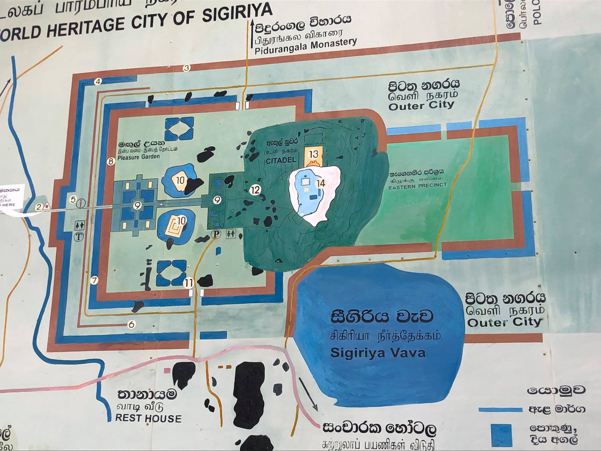
You enter Sigiriya from the far left of this map, where pleasure gardens lie at ground level. Then you progress through the gardens, through one of the gates, and climb 1200 steps up the Lion Rock, past the Mirror Wall and stunning frescoes of the lovely topless ladies, to the top of King Kasyapa’s 5th century palace.
“Sigiriya or Sinhagiri (Lion Rock Sinhalese: සීගිරිය, Tamil: சிகிரியா, pronounced see-gi-ri-yə) is an ancient rock fortress located in the northern Matale District near the town of Dambulla in the Central Province, Sri Lanka. The name refers to a site of historical and archaeological significance that is dominated by a massive column of rock nearly 200 metres (660 ft) high. According to the ancient Sri Lankan chronicle the Culavamsa, this site was selected by King Kasyapa (477 – 495 CE) for his new capital. He built his palace on the top of this rock and decorated its sides with colourful frescoes. On a small plateau about halfway up the side of this rock he built a gateway in the form of an enormous lion. The name of this place is derived from this structure — Sīnhāgiri, the Lion Rock (an etymology similar to Siṃhapura, the Sanskrit name of Singapore, the Lion City). The capital and the royal palace was abandoned after the king’s death. It was used as a Buddhist monastery until the 14th century.
Sigiriya today is a UNESCO listed World Heritage Site. It is one of the best preserved examples of ancient urban planning.” (Wikipedia)
Sigiriya, Sri Lanka.